
WinCan brings new methods and productivity to pipe inspection. Supported by the market’s largest customer base, WinCan invests heavily in research and development to deliver innovation ahead of the competition. So, whether it’s new ways to inspect, new analytical tools or new support for downstream processes like cleaning and rehab—count on WinCan to lead the market.

With four-synchronized views, the ScanExplorer module makes it easy to navigate and analyze data captured from side-scan, laser and manhole inspections. It lets you measure features, track inclination, auto-detect taps and joints, enter standards-compliant observations, and correlate visible defects with structural flaws. ScanExplorer works with all major side-scan and laser brands.
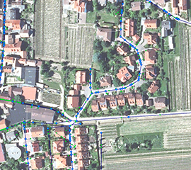
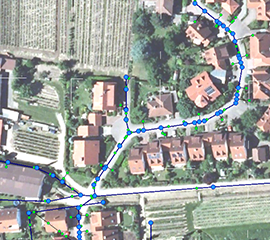
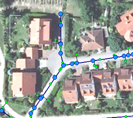
With full-featured GIS implementation plus ArcGIS support, WinCan Map lets you manage infrastructure data using maps as the front end. Simply click and drag on a map to create entire WinCan projects with pre-populated section data. You can also create linked map elements from observations automatically, and augment GIS data with more detailed inspection data.
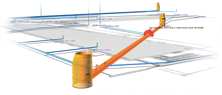
WinCan’s 3D visualization technology lets you build a virtual model of your infrastructure based on measurements gathered during inspection. Such models help you visualize your collection system, verify the accuracy of other records, and plan subsurface work such as excavation and directional drilling. Simply mouse over a section on the 3D view to get complete inspection data or establish bidirectional links with WinCan Map, ArcGIS or any other GIS system.
| Reseller | With Maintenance Contract | No Maintenance Contract | |
 |
WinCan | TeamViewer *** | TeamViewer |
 |
WinCan LLC | TeamViewer *** | TeamViewer |
 |
WinCan Europe | TeamViewer *** | TeamViewer |
 |
WinCan Deutschland | TeamViewer *** | TeamViewer |
Please only select the TeamViewer *** link if you have a WinCan maintenance contract. Once the TeamViewer session is opened, please enter your first and last name into the target field.
Please also note that remote sessions without a maintenance contract will be chargeable.