

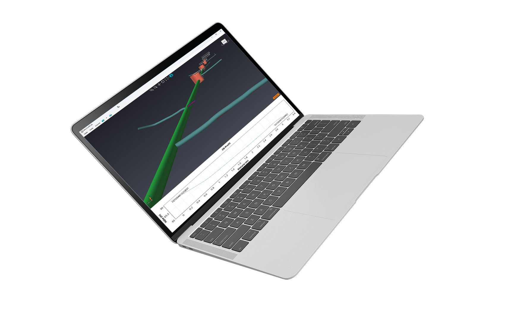
What is WinCan 3D?
WinCan 3D is an advanced visualization and measurement tool that creates accurate 3D representations of sewer pipes and laterals. When used with modern inspection cameras equipped with geo-sensors, the system captures the real-world position and path of a pipe during a standard inspection.
These spatial data (X, Y, Z coordinates) are processed in WinCan VX and visualized in WinCan Map (2D) and WinCan 3D (3D). The result is a lifelike model showing every deviation and elevation change in the pipe course.
For users without geo-sensors, manual 3D modeling is also possible—e.g., using known bend angles or mapped manhole positions. WinCan 3D bridges the gap between traditional inspection and modern GIS-ready infrastructure modeling.
Product
Creates 3D pipe and lateral models using geo-sensor data or manual input Supports both automatic and manual 3D path generation Displays true pipe alignment, slope, and bends in 3D Integrates with WinCan Map for GIS-based positioning Enables DXF and STL export for CAD and BIM use Requires VX Expert license with 3D Measurement module Useful for TV inspections from mainline to lateral Visualizes multiple layers and structures in 3D space.
Product Facts Explained
3D Pipe and Lateral Modeling via Geo-Sensor
When connected to modern cameras with built-in geo-sensors, WinCan captures the exact pipe course in real-time. As the crawler moves, X/Y/Z data are recorded and rendered into a realistic 3D model—representing how the pipe actually lies underground.
Manual 3D Input and Simulation
Even without geo-sensors, users can create 3D pipe paths manually using bend angles, elevation data, or mapped start/endpoints. This allows flexible modeling for legacy projects or when sensors aren’t available.
Realistic Visualization of Alignment, Slope & Bends
The 3D module shows how pipes curve, rise, or drop along their path. This makes it easy to identify vertical drops, misalignments, or complex bends—information critical for rehabilitation planning.
GIS Integration via WinCan Map
Manholes and connection points can be precisely placed on a map using WinCan Map. When combined with 3D visualization, this gives a full spatial context of the sewer system within the GIS environment.
Export to CAD/BIM Formats (DXF, STL)
3D models can be exported in industry-standard formats like DXF or STL, making them usable in CAD and BIM workflows—ideal for engineers, planners, and design teams.
Advanced Layer Management & Visualization Tools
Users can control which layers (pipes, manholes, laterals) are visible and how they’re rendered. View styles, transparency, and orientation tools help navigate and analyze complex networks with ease.
FAQ
Do I need a special license for WinCan 3D?
Yes, you need a WinCan VX Expert license with the 3D Measurement module, which is included in recent VX Expert packages.
Does WinCan 3D work with any inspection camera?
WinCan 3D works best with cameras equipped with geo-sensors that record spatial data during inspection. However, manual 3D modeling is also supported.
Can I use WinCan 3D without running a TV inspection?
Yes, 3D modeling is independent of TV inspection direction and can be created with or without a live inspection.
Can I integrate 3D data with maps or GPS coordinates?
Yes, if manholes or endpoints are georeferenced via maps (e.g., DXF, SHP layers), their coordinates are automatically assigned.
Can I export my 3D models?
Yes, 3D models can be exported as DXF or STL files for use in CAD/BIM platforms or for sharing with partners.


